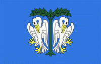
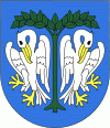
Łowicz
 |
 |
Łowicz was a residence of Polish primates in the Polish–Lithuanian Commonwealth. They served as regents when the town became a temporary "capital" of Poland during the interregnum. As a result, Łowicz has its own bishop and a basilica in spite of its considerably small size. The ruins of a former bishop's castle can be found on the outskirts of town. Napoleon Bonaparte is believed to have stayed in one of the houses on the main square. Also, the town was at the centre of the largest battle of the German invasion of Poland, the Battle of the Bzura River, in the opening campaign of World War II.
Łowicz has an important ethnographic museum (Muzeum w Łowiczu) exhibiting Polish art and historical artifacts from the region. Also, Łowicz features a popular skansen with traditional wooden houses. It is a vast open-air display of historical structures depicting traditional Polish village-life; a collection of artifacts spread over a 17-hectare (42 acre) site, just outside the town.
Near the town is the Maurzyce Bridge, the first welded road-bridge in the world, built in 1928 across the river Słudwia. It was designed in 1927 by Stefan Bryła from the Lwów University of Technology.
Map - Łowicz
Map


Country - Poland
 |
 |
| Flag of Poland | |
Poland has a temperate transitional climate and its territory traverses the Central European Plain, extending from Baltic Sea in the north to Sudeten and Carpathian Mountains in the south. The longest Polish river is the Vistula, and Poland's highest point is Mount Rysy, situated in the Tatra mountain range of the Carpathians. The country is bordered by Lithuania and Russia to the northeast, Belarus and Ukraine to the east, Slovakia and the Czech Republic to the south, and Germany to the west. It also shares maritime boundaries with Denmark and Sweden.
Currency / Language
| ISO | Currency | Symbol | Significant figures |
|---|---|---|---|
| PLN | Polish złoty | zÅ‚ | 2 |
| ISO | Language |
|---|---|
| PL | Polish language |